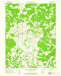
1960 Map of Preston
USGS Topo · Published 1961About this map
Preston sits at the intersection of two major state routes in the Ozark highlands of southern Missouri, serving as a hub for the surrounding rural townships. This 1960 survey by the U.S. Geological Survey captures a landscape defined by traditional community structures, where small rural schools like Morgan Sch and local burial grounds such as Fisher Cem anchored the social fabric. The terrain is deeply carved by watercourses, including Stark Creek and Mill Creek, which flow through the timbered hills and pastureland.
Find a feature on this map
20 named features on this map. Tap any name to fly to it.
Don’t see what you’re looking for? This feature index may not catch every label — zoom into the map to look around manually.
Map Details
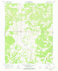
Editions of this 1960 Preston Map
2 editions found
Other maps of this area

1884 · Bolivar
USGS Topo · 1:125,000

1887 · Warsaw
USGS Topo · 1:125,000

1892 · Bolivar
USGS Topo · 1:125,000

1894 · Warsaw
USGS Topo · 1:125,000

1945 · Fristoe
USGS Topo · 1:62,500

1947 · Jefferson City
USGS Topo · 1:250,000

1949 · Sentinel
USGS Topo · 1:24,000

1950 · Sentinel
USGS Topo · 1:24,000

1950 · Urbana
USGS Topo · 1:24,000

1951 · Urbana
USGS Topo · 1:24,000