
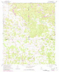
1962 Map of Preston
USGS Topo · Published 1963About this map
The community of Preston and the rural junction of Handle anchor this 1962 landscape where the borders of Winston, Noxubee, and Kemper counties converge. This interior region of Mississippi is defined by its social hubs of country churches and family-named cemeteries, including Good Hope Ch, Mt Hebron Ch, and the Mt Pisgah Cem. The terrain is deeply carved by waterways such as Hashuqua Creek and Dancing Rabbit Creek, with Vernon Mill Pond suggesting earlier small-scale water-powered industry at the northern edge of the sheet.
Find a feature on this map
28 named features on this map. Tap any name to fly to it.
Don’t see what you’re looking for? This feature index may not catch every label — zoom into the map to look around manually.
Map Details
Editions of this 1962 Preston Map
2 editions found
Other maps of this area

1953 · Meridian
USGS Topo · 1:250,000

1953 · West Point
USGS Topo · 1:250,000

1957 · Meridian
USGS Topo · 1:250,000

1958 · West Point
USGS Topo · 1:250,000

1962 · Lynville
USGS Topo · 1:24,000

1962 · Vernon
USGS Topo · 1:24,000

1962 · Owl Creek
USGS Topo · 1:24,000

1963 · West Point
USGS Topo · 1:250,000

1963 · De Kalb
USGS Topo · 1:24,000

1963 · Gholson
USGS Topo · 1:24,000