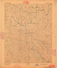
1892 Map of Prestonsburg
USGS Topo · Published 1898About this map
Paintsville and Prestonburg anchor this late 19th-century survey of the Eastern Kentucky coalfield region, a landscape defined by the deep dissection of the Cumberland Plateau. The Big Sandy River Levisa Fork winds through the heart of the territory, serving as the primary drainage for a dense network of steep hollows and named forks. Transport in this era was dominated by the river and the Chattaroi Railway, which reaches into the northern reaches near Peach Orchard and Richardson.
Find a feature on this map
92 named features on this map. Tap any name to fly to it.
Don’t see what you’re looking for? This feature index may not catch every label — zoom into the map to look around manually.
Map Details
Editions of this 1892 Prestonsburg Map
4 editions found

Other maps of this area

1886 · Prestonsburg
USGS Topo · 1:125,000

1886 · Grundy
USGS Topo · 1:125,000

1887 · Warfield
USGS Topo · 1:125,000

1889 · Salyersville
USGS Topo · 1:125,000

1890 · Whitesburg
USGS Topo · 1:125,000

1890 · Grundy
USGS Topo · 1:125,000

1891 · Hazard
USGS Topo · 1:125,000

1891 · Salyersville
USGS Topo · 1:125,000

1891 · Warfield
USGS Topo · 1:125,000

1892 · Grundy
USGS Topo · 1:125,000