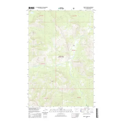
2017 Map of Pretty Prairie
USGS Topo · Published 2017About this map
Pretty Prairie sits at the heart of this backcountry landscape, situated within the vast expanse of the Lewis & Clark National Forest. The hydrology of this high-elevation region is defined by the South Fork Sun River and its major tributary, the West Fork South Fork Sun River. The terrain is characterized by a dense network of mountain drainages, including Wapiti Cr, Windfall Cr, and Goat Cr, which carve through the slopes near Deadman Hill. This 2017 survey reflects a wilderness area where natural landmarks and watercourses dominate the map, with features like Bear Lake in the northwest corner serving as primary points of orientation. The lack of modern infrastructure highlights the preserved nature of the upper Sun River drainage, providing a clear look at the topographic relief and primitive waterways that have defined this portion of Lewis and Clark County for generations.
Find a feature on this map
21 named features on this map. Tap any name to fly to it.
Don’t see what you’re looking for? This feature index may not catch every label — zoom into the map to look around manually.
Map Details
Editions of this 2017 Pretty Prairie Map
This is the sole edition of this map. No revisions or reprints were ever made.
Other maps of this area

1902 · Ovando
USGS Topo · 1:125,000

1903 · Saypo
USGS Topo · 1:125,000

1903 · Coopers Lake
USGS Topo · 1:125,000

1905 · Ovando
USGS Topo · 1:125,000

1936 · Silvertip
USGS Topo · 1:96,000

1942 · Silvertip
USGS Topo · 1:125,000

1955 · Choteau
USGS Topo · 1:250,000

1957 · Choteau
USGS Topo · 1:250,000

1958 · Choteau
USGS Topo · 1:250,000

1958 · Glenn Creek
USGS Topo · 1:24,000