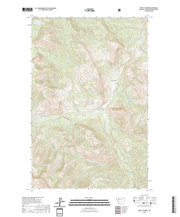
2024 Map of Pretty Prairie
USGS Topo · Published 2024About this map
Pretty Prairie sits at a critical junction of high-country drainage and wilderness boundaries within the Lewis & Clark National Forest. This landscape is defined by the convergence of the West Fork South Fork Sun River and the main South Fork Sun River, a network of waterways that has long dictated movement through these mountains. The map illustrates a strictly non-motorized infrastructure, where travel is relegated to an extensive trail system including the Continental Divide National Scenic Trl and specialized routes like the Prairie Admin Connector Trl. The transition between the Bob Marshall Wilderness and the Scapegoat Wilderness is marked by prominent natural landmarks such as Deadman Hill and Bear Lake, reflecting a region managed for its primitive character. The lack of modern road development highlights the area's preservation as a corridor for backcountry travel and watershed protection.
Find a feature on this map
33 named features on this map. Tap any name to fly to it.
Don’t see what you’re looking for? This feature index may not catch every label — zoom into the map to look around manually.
Map Details
Editions of this 2024 Pretty Prairie Map
This is the sole edition of this map. No revisions or reprints were ever made.
Other maps of this area

1902 · Ovando
USGS Topo · 1:125,000

1903 · Saypo
USGS Topo · 1:125,000

1903 · Coopers Lake
USGS Topo · 1:125,000

1905 · Ovando
USGS Topo · 1:125,000

1936 · Silvertip
USGS Topo · 1:96,000

1942 · Silvertip
USGS Topo · 1:125,000

1955 · Choteau
USGS Topo · 1:250,000

1957 · Choteau
USGS Topo · 1:250,000

1958 · Choteau
USGS Topo · 1:250,000

1958 · Glenn Creek
USGS Topo · 1:24,000