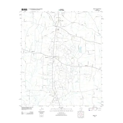
2013 Map of Price
USGS Topo · Published 2013About this map
New London and its surrounding oil-era hamlets define this portion of Rusk County, showcasing a dense network of residential streets and industrial corridors. The landscape is marked by the proximity of Old London, London, and Turnertown, settlements that grew during the East Texas oil boom. This 2013 survey illustrates how modern infrastructure like E Texas Refinery Rd and Humble Rd E integrates with the older rural fabric. Local history and genealogy are preserved through several family and community landmarks, including Asbury Cem near the western edge and Black Jack Cem to the southeast. The natural drainage of the region is characterized by numerous small waterways such as Bowles Cr and Johnson Cr, which thread between the concentrated developments of Selman City and Joinerville.
Find a feature on this map
117 named features on this map. Tap any name to fly to it.
Don’t see what you’re looking for? This feature index may not catch every label — zoom into the map to look around manually.
Map Details
Editions of this 2013 Price Map
This is the sole edition of this map. No revisions or reprints were ever made.
Other maps of this area

1935 · Henderson
USGS Topo · 1:48,000

1936 · Kilgore
USGS Topo · 1:48,000

1937 · Troupe
USGS Topo · 1:48,000

1938 · Winona
USGS Topo · 1:48,000

1939 · Henderson
USGS Topo · 1:62,500

1940 · Kilgore
USGS Topo · 1:62,500

1943 · Troup
USGS Topo · 1:62,500

1943 · Winona
USGS Topo · 1:62,500

1956 · Tyler
USGS Topo · 1:250,000

1966 · Hope Pond
USGS Topo · 1:24,000