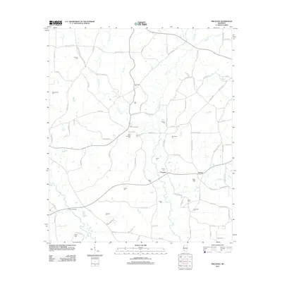
2012 Map of Pricedale
USGS Topo · Published 2012About this map
Pricedale and Topisaw anchor this Mississippi landscape, where small rural settlements are defined by an extensive network of family-named cemeteries and the winding course of Topisaw Cr. The map reveals a deeply rooted community structure, as evidenced by the high density of burial sites such as Calvary Cem, Turnipseed Cem, and Labon Bacot Cem that dot the countryside. This area in Pike County also supports significant industry and recreation, ranging from the Little Creek Oil Field in the west to the public space at John Felder Memorial Park and the gathering grounds of Felders Campground. Waterways like Dog River and the Bogue Chitto cut through the terrain, historically shaping the placement of homesteads and local roads like McCullough Rd SE.
Find a feature on this map
92 named features on this map. Tap any name to fly to it.
Don’t see what you’re looking for? This feature index may not catch every label — zoom into the map to look around manually.
Map Details
Editions of this 2012 Pricedale Map
This is the sole edition of this map. No revisions or reprints were ever made.
Other maps of this area

1953 · Natchez
USGS Topo · 1:250,000

1956 · Natchez
USGS Topo · 1:250,000

1959 · Natchez
USGS Topo · 1:250,000

1970 · Mesa
USGS Topo · 1:24,000

1970 · Topeka
USGS Topo · 1:24,000

1970 · Jayess
USGS Topo · 1:24,000

1972 · Ruth
USGS Topo · 1:24,000

1972 · Pricedale
USGS Topo · 1:24,000

1972 · Bogue Chitto
USGS Topo · 1:24,000

1972 · McComb South
USGS Topo · 1:24,000