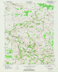
1951 Map of Prices Mill
USGS Topo · Published 1967About this map
The Red River meanders through the heart of this borderland survey, anchoring a landscape where small rural settlements and country crossroads define the social geography of the mid-century. Centered on Prices Mill and the scattered hamlets of Middleton, Neosheo, and Providence, the map reveals a community structured around its spiritual and educational landmarks. Local life is traced through several country churches, including White Hill Ch, Milliken Chapel, and Bethany Ch, alongside the Red River Sch.
Find a feature on this map
18 named features on this map. Tap any name to fly to it.
Don’t see what you’re looking for? This feature index may not catch every label — zoom into the map to look around manually.
Map Details
Editions of this 1951 Prices Mill Map
2 editions found
Other maps of this area

1942 · Gallatin
USGS Topo · 1:100,000

1951 · Adairville
USGS Topo · 1:24,000

1951 · Woodburn
USGS Topo · 1:24,000

1951 · Franklin
USGS Topo · 1:24,000

1951 · Prices Mill
USGS Topo · 1:24,000

1951 · Auburn
USGS Topo · 1:24,000

1952 · Youngville
USGS Topo · 1:24,000

1952 · Dennis
USGS Topo · 1:24,000

1953 · Orlinda
USGS Topo · 1:24,000
1956 · Portland
USGS Topo · 1:24,000