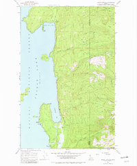
1967 Map of Priest Lake SE
USGS Topo · Published 1982About this map
Priest Lake dominates the western half of this Idaho panhandle survey, revealing a landscape defined by the water-access communities of Fenton and Sherwood Beach. The shoreline is heavily indented with natural features like Cavanaugh Bay, Steamboat Bay, and Indian Creek Bay, providing protected waters for local recreation and transportation. The 1967 field check highlights the integration of air and water travel at the Cavanaugh Bay Airport, situated just inland from the beach.
Find a feature on this map
28 named features on this map. Tap any name to fly to it.
Don’t see what you’re looking for? This feature index may not catch every label — zoom into the map to look around manually.
Map Details
Editions of this 1967 Priest Lake SE Map
3 editions found
Other maps of this area

1901 · Sandpoint
USGS Topo · 1:125,000

1911 · Priest Lake
USGS Topo · 1:250,000

1911 · Sandpoint
USGS Topo · 1:125,000

1913 · Priest Lake
USGS Topo · 1:250,000

1958 · Sandpoint
USGS Topo · 1:250,000

1963 · Sandpoint
USGS Topo · 1:250,000

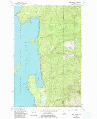
1967 · Priest Lake SE
USGS Topo · 1:24,000

1967 · Coolin
USGS Topo · 1:24,000

1967 · Priest Lake NE
USGS Topo · 1:24,000

1967 · Priest Lake NW
USGS Topo · 1:24,000