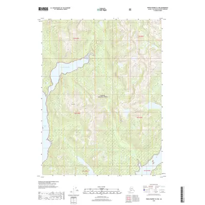
2018 Map of Prince Rupert D-2 NW
USGS Topo · Published 2018About this map
Tongass National Forest dominates the interior of this coastal Alaskan landscape, where the steep terrain of the Alexander Archipelago meets the sea. The map centers on Cone Mtn, a prominent peak rising amidst a network of unnamed ridges and glacial valleys. Along the western edge, the coastline is defined by the narrow, sheltered waters of Willard Inlet, while the northern portion of the sheet opens into a broad expanse of the Pacific Ocean. This 2018 survey reveals a wilderness area devoid of modern road networks or settlements, instead emphasizing the natural topography and the intersection of maritime and forest environments within the Ketchikan Gateway region. The intricate contour lines illustrate the sharp elevation changes characteristic of this maritime forest, providing a detailed look at the drainage patterns flowing from the high ridges down to the inlets below.
Find a feature on this map
10 named features on this map. Tap any name to fly to it.
Don’t see what you’re looking for? This feature index may not catch every label — zoom into the map to look around manually.
Map Details
Editions of this 2018 Prince Rupert D-2 NW Map
This is the sole edition of this map. No revisions or reprints were ever made.
Other maps of this area

1951 · Prince Rupert
USGS Topo · 1:250,000

1952 · Ketchikan
USGS Topo · 1:250,000

1955 · Ketchikan A-2
USGS Topo · 1:63,360

1955 · Prince Rupert D-3
USGS Topo · 1:63,360

1955 · Ketchikan A-3
USGS Topo · 1:63,360

1955 · Prince Rupert D-2
USGS Topo · 1:63,360

1955 · Ketchikan
USGS Topo · 1:250,000

1959 · Prince Rupert
USGS Topo · 1:250,000

1964 · Prince Rupert
USGS Topo · 1:250,000
2018 · Ketchikan A-2 SW
USGS Topo · 1:25,000