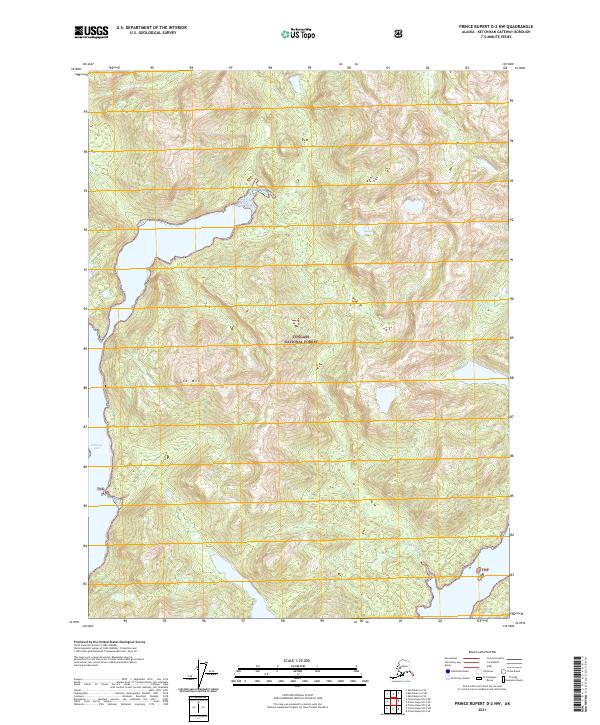
2021 Map of Prince Rupert D-2 NW
USGS Topo · Published 2021About this map
Tongass National Forest dominates this coastal Alaskan landscape, where the saltwater reaches of Willard Inlet penetrate deep into the mountainous terrain of the Alexander Archipelago. The topography is defined by significant vertical relief, rising from the shoreline to the prominent peak of Cone Mtn in the southern interior. This modern survey illustrates a wilderness nearly devoid of human infrastructure, focused instead on the complex drainage patterns of the coastal rainforest, including the steep descent of Billy Goat Cr in the northeast. The map provides a precise record of the Public Land Survey System boundaries, tracing the township and range lines of t80s r98e and t79s r99e across a landscape where natural features dictate the limits of exploration.
Find a feature on this map
12 named features on this map. Tap any name to fly to it.
Don’t see what you’re looking for? This feature index may not catch every label — zoom into the map to look around manually.
Map Details
Editions of this 2021 Prince Rupert D-2 NW Map
This is the sole edition of this map. No revisions or reprints were ever made.
Other maps of this area

1951 · Prince Rupert
USGS Topo · 1:250,000

1952 · Ketchikan
USGS Topo · 1:250,000

1955 · Ketchikan A-2
USGS Topo · 1:63,360

1955 · Prince Rupert D-3
USGS Topo · 1:63,360

1955 · Ketchikan A-3
USGS Topo · 1:63,360

1955 · Prince Rupert D-2
USGS Topo · 1:63,360

1955 · Ketchikan
USGS Topo · 1:250,000

1959 · Prince Rupert
USGS Topo · 1:250,000

1964 · Prince Rupert
USGS Topo · 1:250,000
2018 · Ketchikan A-2 SW
USGS Topo · 1:25,000