
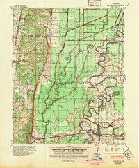
1940 Map of Princedale
USGS Topo · Published 1942About this map
The St Francis River meanders through this portion of eastern Arkansas, defining a landscape of complex waterways and early 20th-century drainage engineering. The map reveals the extensive network of canals like Ditch No 1 and Ditch No 10 which were vital for managing the swampy terrain. Small communities such as Whitehall, Hydrick, and Princedale are linked by the Missouri Pacific and St Louis Southwestern railroads.
Find a feature on this map
89 named features on this map. Tap any name to fly to it.
Don’t see what you’re looking for? This feature index may not catch every label — zoom into the map to look around manually.
Map Details
Editions of this 1940 Princedale Map
2 editions found
Other maps of this area

1939 · Vanndale
USGS Topo · 1:62,500

1939 · Weiner
USGS Topo · 1:62,500

1939 · Wynne
USGS Topo · 1:62,500

1939 · Edmondson
USGS Topo · 1:62,500

1940 · Deckerville
USGS Topo · 1:62,500

1940 · Whitmore
USGS Topo · 1:62,500

1940 · Dee
USGS Topo · 1:62,500

1941 · Marked Tree
USGS Topo · 1:62,500

1953 · Memphis
USGS Topo · 1:250,000

1954 · Edmondson
USGS Topo · 1:62,500