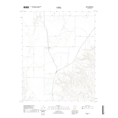
2019 Map of Pringle
USGS Topo · Published 2019About this map
Pringle stands as the primary settlement on this Hutchinson County landscape, situated at the intersection of local routes and modern infrastructure. The terrain is defined by the drainage patterns of the Texas Panhandle, where the prominent Bugby Creek and Cottonwood Cr carve through the southern portion of the quadrangle. These watercourses, along with Big Cr, illustrate the transition from open agricultural and ranching plains to more complex gully systems.
Find a feature on this map
21 named features on this map. Tap any name to fly to it.
Don’t see what you’re looking for? This feature index may not catch every label — zoom into the map to look around manually.
Map Details
Editions of this 2019 Pringle Map
This is the sole edition of this map. No revisions or reprints were ever made.
Other maps of this area

1953 · Plemons
USGS Topo · 1:24,000

1953 · Stinnett
USGS Topo · 1:24,000

1953 · Stinnett Station
USGS Topo · 1:24,000

1953 · Pringle
USGS Topo · 1:24,000

1954 · Perryton
USGS Topo · 1:250,000

1954 · Amarillo
USGS Topo · 1:250,000

1958 · Perryton
USGS Topo · 1:250,000

1958 · Amarillo
USGS Topo · 1:250,000

1974 · Morse
USGS Topo · 1:24,000
1974 · Camp Creek
USGS Topo · 1:24,000