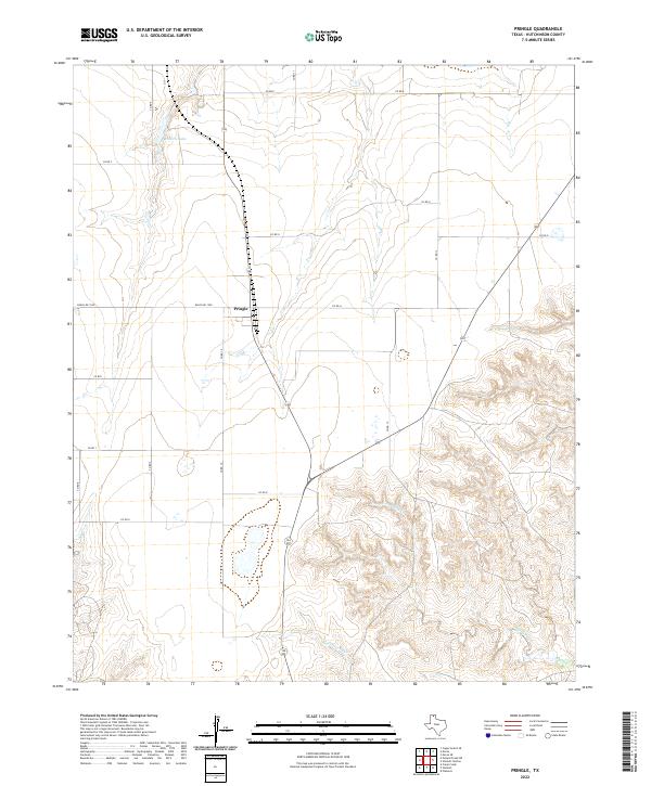
2022 Map of Pringle
USGS Topo · Published 2022About this map
Pringle sits at the intersection of several regional transport arteries in the Texas Panhandle, anchoring a landscape where the flat high plains give way to the intricate drainage systems of the Canadian River basin. The northern portion of the map is defined by a rigid grid of county roads, such as Co RD E and Co RD F, serving the agricultural reaches near Roberts Lake. This orderly surveyor's grid breaks down in the southeast, where the terrain becomes increasingly dissected by the winding courses of Bugby Creek and Cottonwood Cr. The contrast between the upland ranching and farming tracts and these deep-set seasonal drainages illustrates the fundamental role of water and topography in shaping the settlement patterns of Hutchinson County. Local infrastructure, including Ranch Rd 1598 and various county routes, provides a network connecting the isolated ranching outposts to the small hub at Pringle.
Find a feature on this map
20 named features on this map. Tap any name to fly to it.
Don’t see what you’re looking for? This feature index may not catch every label — zoom into the map to look around manually.
Map Details
Editions of this 2022 Pringle Map
This is the sole edition of this map. No revisions or reprints were ever made.
Other maps of this area

1953 · Plemons
USGS Topo · 1:24,000

1953 · Stinnett
USGS Topo · 1:24,000

1953 · Stinnett Station
USGS Topo · 1:24,000

1953 · Pringle
USGS Topo · 1:24,000

1954 · Perryton
USGS Topo · 1:250,000

1954 · Amarillo
USGS Topo · 1:250,000

1958 · Perryton
USGS Topo · 1:250,000

1958 · Amarillo
USGS Topo · 1:250,000

1974 · Morse
USGS Topo · 1:24,000
1974 · Camp Creek
USGS Topo · 1:24,000