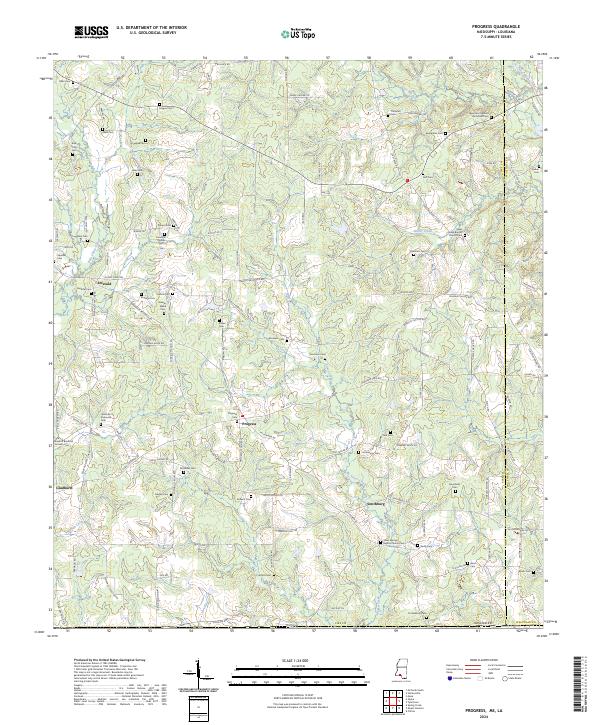
2024 Map of Progress
USGS Topo · Published 2024About this map
Bala Chitto Creek and Silver Creek define the drainage of this rural landscape along the Mississippi-Louisiana border. Small agricultural and residential clusters are centered on Progress, Emerald, Gladhurst, and Smithburg, reflecting a long-standing settlement pattern in Pike County. The map is particularly rich in genealogical data, preserving the locations of numerous family-named burial grounds like the Jesse and Hannah Brumfield Cem and the Solomon O Simmons Cem. These small family plots, along with larger congregational sites such as Silver Springs Baptist Church Cem, provide a detailed record of the families who established these communities. The terrain is crisscrossed by local connectors like Pike 93 Central and Raborn Rd, which link the various homesteads and cemeteries scattered across the undulating countryside between the Bogue Chitto and McNab Creek.
Find a feature on this map
118 named features on this map. Tap any name to fly to it.
Don’t see what you’re looking for? This feature index may not catch every label — zoom into the map to look around manually.
Map Details
Editions of this 2024 Progress Map
This is the sole edition of this map. No revisions or reprints were ever made.
Other maps of this area

1939 · Sunny Hill
USGS Topo · 1:31,680

1939 · Clifton
USGS Topo · 1:31,680

1940 · Spring Creek
USGS Topo · 1:31,680

1953 · Natchez
USGS Topo · 1:250,000

1954 · Baton Rouge
USGS Topo · 1:250,000

1956 · Natchez
USGS Topo · 1:250,000

1956 · Baton Rouge
USGS Topo · 1:250,000
1958 · Mount Hermon
USGS Topo · 1:62,500
1958 · Franklinton
USGS Topo · 1:62,500

1959 · Natchez
USGS Topo · 1:250,000