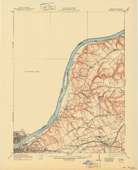
1912 Map of Prospect
USGS Topo · Published 1941About this map
The Ohio River corridor north of Louisville reveals a landscape transitioning from suburban growth to riverfront landings and rural estates. Along the river, historical transport points like Woolfolk Ldg and Halls Landing serve the river traffic, while the interior is defined by established institutional grounds such as the Lakeland Asylum and the Kentucky Military Institute. The network of turnpikes, including the Sligo and Goshen Turnpike and Brownsboro Road, links together scattered settlements like Prospect and Goshen. To the south, the expansion of the Louisville and Nashville Electric line indicates the early 20th-century trend of suburbanization, connecting the city to outlying communities like Lyndon and Anchorage. Family-named landmarks and local hubs like the Antioch Church and Poplar Grove School provide specific points of interest for those tracing the social geography of Jefferson and Oldham counties.
Find a feature on this map
58 named features on this map. Tap any name to fly to it.
Don’t see what you’re looking for? This feature index may not catch every label — zoom into the map to look around manually.
Map Details
Editions of this 1912 Prospect Map
3 editions found
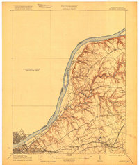
Other maps of this area

1905 · Prospect
USGS Topo · 1:62,500

1907 · Louisville
USGS Topo · 1:62,500

1909 · Kosmosdale
USGS Topo · 1:48,000

1912 · Prospect
USGS Topo · 1:62,500

1912 · Kosmosdale
USGS Topo · 1:62,500

1929 · Taylorsville
USGS Topo · 1:62,500

1932 · La Grange
USGS Topo · 1:62,500

1937 · Jeffersonville
USGS Topo · 1:24,000

1937 · Charlestown
USGS Topo · 1:24,000

1938 · Owen
USGS Topo · 1:24,000