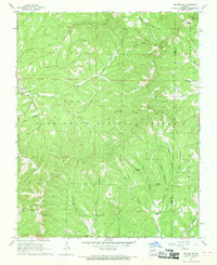
1968 Map of Protem NE
USGS Topo · Published 1969About this map
Hercules and Fairview anchor the western edge of this survey, which predominantly covers the dense forest and ridges along the Taney and Ozark County line. Much of the landscape is contained within the Mark Twain National Forest, defined by significant relief such as Clayton Ridge and Pelham Ridge. The drainage system is particularly well-documented here, featuring the Big Creek valley and its numerous tributaries like East Fork Big Creek and Brushy Creek.
Find a feature on this map
32 named features on this map. Tap any name to fly to it.
Don’t see what you’re looking for? This feature index may not catch every label — zoom into the map to look around manually.
Map Details
Editions of this 1968 Protem NE Map
2 editions found
Other maps of this area

1936 · Thornfield
USGS Topo · 1:48,000

1936 · Ava
USGS Topo · 1:48,000

1937 · Bradleyville
USGS Topo · 1:48,000

1942 · Ava
USGS Topo · 1:62,500

1943 · Protem
USGS Topo · 1:62,500

1943 · Thornfield
USGS Topo · 1:62,500

1943 · Bradleyville
USGS Topo · 1:62,500

1945 · Ava
USGS Topo · 1:62,500

1945 · Harrison
USGS Topo · 1:250,000

1945 · Thornfield
USGS Topo · 1:62,500