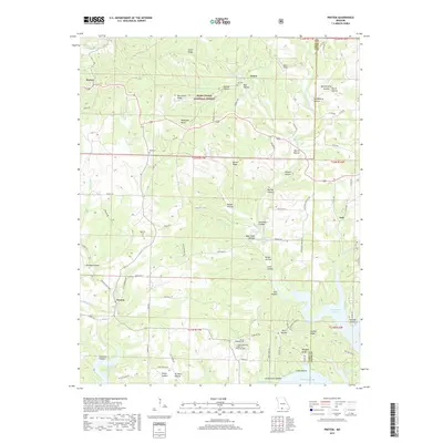
2017 Map of Protem
USGS Topo · Published 2017About this map
Rueter and Protem anchor this survey of the White River hills along the southern border of Missouri, where the landscape is defined by the expansive waters of Bull Shoals Lake. The map captures a transition between the high ridges of the Mark Twain National Forest and the deeply recessed hollows that drain into the reservoir. Local family history and settlement patterns are preserved through features like Merritt Cem, Wolf Cem, and the small community of Nance. The rugged topography is marked by named summits like Blackjack Knob and Goetz Ridge, while the water's edge at Nolands Point illustrates the impact of the mid-century impoundment of the White River on local geography. Remote springs, such as Schoolhouse Spring and Owens Spring, highlight the traditional water sources that once supported these rural Ozark communities.
Find a feature on this map
99 named features on this map. Tap any name to fly to it.
Don’t see what you’re looking for? This feature index may not catch every label — zoom into the map to look around manually.
Map Details
Editions of this 2017 Protem Map
This is the sole edition of this map. No revisions or reprints were ever made.
Other maps of this area

1893 · Yellville
USGS Topo · 1:125,000

1903 · Yellville
USGS Topo · 1:125,000

1905 · Yellville
USGS Topo · 1:125,000

1929 · Yellville
USGS Topo · 1:125,000

1936 · Thornfield
USGS Topo · 1:48,000

1943 · Protem
USGS Topo · 1:62,500

1943 · Thornfield
USGS Topo · 1:62,500

1945 · Harrison
USGS Topo · 1:250,000

1945 · Thornfield
USGS Topo · 1:62,500

1949 · Harrison
USGS Topo · 1:250,000