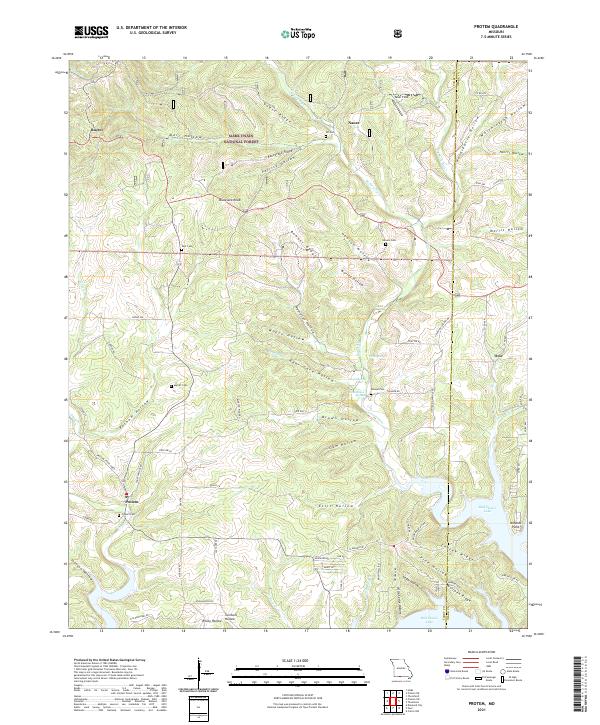
2021 Map of Protem
USGS Topo · Published 2021About this map
Protem and its surrounding Ozark highlands are defined by a complex network of hollows and ridges within the Mark Twain National Forest. The landscape is etched by named drainages like Pelham Hollow, Bear Cave Hollow, and Eslic Hollow, which feed into the northern reaches of Bull Shoals Lake. This 2021 survey reveals a deeply rooted rural geography, where small settlements such as Rueter, Nance, and Ocie are linked by winding roads like State Hwy U and Rozell Rd. Genealogists will find a wealth of local landmarks, including several family-named burial sites such as Wolf Cem, Merritt Cem, and Henson Cem. The presence of Taber Field and significant terrain markers like Blackjack Knob and Goetz Ridge illustrate how the physical geography shaped the human habitation patterns in this portion of Taney County, where the topography transitions from wooded ridges down to the shoreline at Nolands Point.
Find a feature on this map
93 named features on this map. Tap any name to fly to it.
Don’t see what you’re looking for? This feature index may not catch every label — zoom into the map to look around manually.
Map Details
Editions of this 2021 Protem Map
This is the sole edition of this map. No revisions or reprints were ever made.
Other maps of this area

1893 · Yellville
USGS Topo · 1:125,000

1903 · Yellville
USGS Topo · 1:125,000

1905 · Yellville
USGS Topo · 1:125,000

1929 · Yellville
USGS Topo · 1:125,000

1936 · Thornfield
USGS Topo · 1:48,000

1943 · Protem
USGS Topo · 1:62,500

1943 · Thornfield
USGS Topo · 1:62,500

1945 · Harrison
USGS Topo · 1:250,000

1945 · Thornfield
USGS Topo · 1:62,500

1949 · Harrison
USGS Topo · 1:250,000