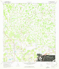
1975 Map of Providence
USGS Topo · Published 1976About this map
Providence serves as the central hub of this mid-1970s landscape in Polk County, where agricultural roots meet a developing rural infrastructure. The area is characterized by a network of localized settlements including Orangedale and Fox Town, interspersed with numerous Fish Hatchery facilities and specialized transport features like Mc Collum Airport and a designated Landing Strip. The presence of the German Ch and Providence Ch suggests long-standing community centers established well before the modern road expansion.
Find a feature on this map
34 named features on this map. Tap any name to fly to it.
Don’t see what you’re looking for? This feature index may not catch every label — zoom into the map to look around manually.
Map Details
Editions of this 1975 Providence Map
Other maps of this area

1944 · Plant City
USGS Topo · 1:31,680

1944 · Providence
USGS Topo · 1:31,680

1944 · Polk City
USGS Topo · 1:31,680

1944 · Lakeland
USGS Topo · 1:31,680

1944 · Auburndale
USGS Topo · 1:31,680

1944 · Socrum
USGS Topo · 1:31,680

1955 · Plant City
USGS Topo · 1:250,000

1955 · Orlando
USGS Topo · 1:250,000

1957 · Orlando
USGS Topo · 1:250,000

1958 · Orlando
USGS Topo · 1:250,000