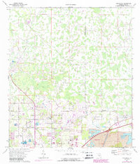
1975 Map of Providence
USGS Topo · Published 1988About this map
Providence serves as a central hub in this Polk County landscape during the mid-1970s, characterized by a transition from rural homesteads to industrial extraction. To the south and east, the expansion of Lakeland is evident, while the presence of Strip Mines in the southeast corner reflects the region's significant phosphate mining economy. The map preserves the locations of local landmarks such as German Ch and the Radio Tower, alongside smaller community clusters like Orangedale and Fox Town. This survey captures the area just as suburban development began encroaching on the network of local thoroughfares, including Socrum Loop Rd and Rock Ridge Road. Transportation and utility infrastructure are well-documented, from the McCollum Airport and its associated Drag Strip Rd to several scattered Fish Hatchery sites that dot the wetland-heavy terrain.
Find a feature on this map
31 named features on this map. Tap any name to fly to it.
Don’t see what you’re looking for? This feature index may not catch every label — zoom into the map to look around manually.
Map Details
Editions of this 1975 Providence Map
Other maps of this area

1944 · Plant City
USGS Topo · 1:31,680

1944 · Providence
USGS Topo · 1:31,680

1944 · Polk City
USGS Topo · 1:31,680

1944 · Lakeland
USGS Topo · 1:31,680

1944 · Auburndale
USGS Topo · 1:31,680

1944 · Socrum
USGS Topo · 1:31,680

1955 · Plant City
USGS Topo · 1:250,000

1955 · Orlando
USGS Topo · 1:250,000

1957 · Orlando
USGS Topo · 1:250,000

1958 · Orlando
USGS Topo · 1:250,000