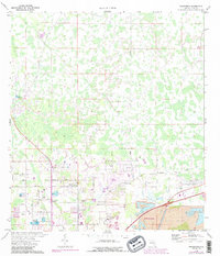
1975 Map of Providence
USGS Topo · Published 1988About this map
Providence and Fox Town anchor this mid-1970s view of Polk County, where the transition from agricultural land to industrial and residential expansion is evident. The landscape is defined by a heavy concentration of Fish Hatchery ponds and the encroaching presence of large-scale Strip Mines along the southern edge near Lakeland. This era shows a community rooted in local institutions, such as German Ch and Providence Ch, alongside modern infrastructure like the Mc Collum Airport and a prominent Radio Tower.
Find a feature on this map
24 named features on this map. Tap any name to fly to it.
Don’t see what you’re looking for? This feature index may not catch every label — zoom into the map to look around manually.
Map Details
Editions of this 1975 Providence Map
Other maps of this area

1944 · Plant City
USGS Topo · 1:31,680

1944 · Providence
USGS Topo · 1:31,680

1944 · Polk City
USGS Topo · 1:31,680

1944 · Lakeland
USGS Topo · 1:31,680

1944 · Auburndale
USGS Topo · 1:31,680

1944 · Socrum
USGS Topo · 1:31,680

1955 · Plant City
USGS Topo · 1:250,000

1955 · Orlando
USGS Topo · 1:250,000

1957 · Orlando
USGS Topo · 1:250,000

1958 · Orlando
USGS Topo · 1:250,000