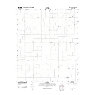
2012 Map of Providence
USGS Topo · Published 2012About this map
Providence and its surrounding agricultural landscape are defined by a grid-like network of rural roads and scattered cotton processing facilities in this 2012 survey of Floyd County. The small community is anchored by industrial sites such as Crume Gin and Providence Gin, which reflect the region's enduring reliance on cotton production and processing. The flat High Plains terrain is minimally interrupted, with Rock Draw providing one of the few natural drainage features in an otherwise heavily engineered landscape of county roads and ranch-to-market routes. Aviation interests are represented by Whitfield Airport, situated north of the main settlement. This map captures the modern layout of the Texas Panhandle's farming infrastructure, where transportation routes like Ranch Road 788 and Ranch Road 2301 connect isolated homesteads and processing hubs to the wider regional economy.
Find a feature on this map
29 named features on this map. Tap any name to fly to it.
Don’t see what you’re looking for? This feature index may not catch every label — zoom into the map to look around manually.
Map Details
Editions of this 2012 Providence Map
This is the sole edition of this map. No revisions or reprints were ever made.
Other maps of this area

1954 · Plainview
USGS Topo · 1:250,000

1958 · Plainview
USGS Topo · 1:250,000

1965 · Rock Creek
USGS Topo · 1:24,000

1965 · Silverton SW
USGS Topo · 1:24,000

1965 · Plainview
USGS Topo · 1:24,000

1966 · Sterley
USGS Topo · 1:24,000

1968 · Aiken
USGS Topo · 1:24,000

1969 · Kress East
USGS Topo · 1:24,000

1969 · Claytonville
USGS Topo · 1:24,000

1969 · Claytonville NW
USGS Topo · 1:24,000