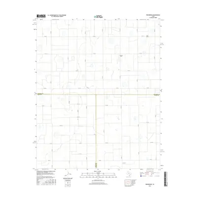
2016 Map of Providence
USGS Topo · Published 2016About this map
Providence and its surrounding agricultural plains are defined by a strictly surveyed grid of county roads and farm-to-market routes that traverse the High Plains. This landscape, situated where the borders of Hale and Floyd counties meet, is characterized by numerous small, intermittent depressions and the drainage of Rock Draw to the northeast. The presence of Whitfield Airport suggests the continued importance of aerial accessibility for the region's large-scale ranching or farming operations. The network of roads, including FM 2301 and FM 1612, connects isolated farmsteads across the flat terrain, illustrating a settlement pattern where distance is mediated by a highly structured transportation system. These features collectively represent the enduring character of West Texas land use and rural infrastructure at the start of the twenty-first century.
Find a feature on this map
28 named features on this map. Tap any name to fly to it.
Don’t see what you’re looking for? This feature index may not catch every label — zoom into the map to look around manually.
Map Details
Editions of this 2016 Providence Map
This is the sole edition of this map. No revisions or reprints were ever made.
Other maps of this area

1954 · Plainview
USGS Topo · 1:250,000

1958 · Plainview
USGS Topo · 1:250,000

1965 · Rock Creek
USGS Topo · 1:24,000

1965 · Silverton SW
USGS Topo · 1:24,000

1965 · Plainview
USGS Topo · 1:24,000

1966 · Sterley
USGS Topo · 1:24,000

1968 · Aiken
USGS Topo · 1:24,000

1969 · Kress East
USGS Topo · 1:24,000

1969 · Claytonville
USGS Topo · 1:24,000

1969 · Claytonville NW
USGS Topo · 1:24,000