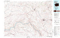
1982 Map of Pullman
USGS Topo · Published 1982About this map
The rolling hills of The Palouse dominate this 1982 map, revealing the intricate drainage patterns of the Palouse River and its many tributaries like Union Flat Creek and Rebel Flat Creek. The regional importance of the Snake River is highlighted by the presence of the Lower Granite Dam, which creates the expansive Lake Bryan and Lake Herbert G West. These reservoirs transformed the river into a series of navigable pools, fundamentally altering the local geography and transportation network for river-borne commerce.
Find a feature on this map
81 named features on this map. Tap any name to fly to it.
Don’t see what you’re looking for? This feature index may not catch every label — zoom into the map to look around manually.
Map Details
Editions of this 1982 Pullman Map
This is the sole edition of this map. No revisions or reprints were ever made.
Other maps of this area

1903 · Oakesdale
USGS Topo · 1:125,000

1905 · Oakesdale
USGS Topo · 1:125,000

1910 · Pullman
USGS Topo · 1:125,000

1919 · Walla Walla
USGS Topo · 1:125,000

1921 · Walla Walla
USGS Topo · 1:125,000

1937 · Pomeroy
USGS Topo · 1:96,000

1942 · Pomeroy
USGS Topo · 1:125,000

1943 · Peola
USGS Topo · 1:62,500

1945 · Clarkston
USGS Topo · 1:62,500

1946 · Peola
USGS Topo · 1:62,500