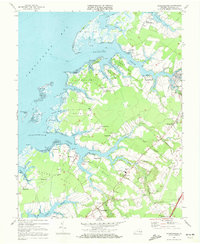
1968 Map of Pungoteague
USGS Topo · Published 1972About this map
The coastal landscape of Accomack County is defined by a dense network of tidal inlets and peninsulas, locally referred to as necks. Sluitkill Neck, Yeo Neck, and Hacks Neck dominate the central topography, separated by the winding reaches of Pungoteague Creek and Nandua Creek. These waterways were central to the region's economy and social structure, evidenced by several landings and wharves such as Finneys Wharf and Cashville. Inland, the settlement pattern centers on small crossroads communities and family-named hamlets like Crockett Town and Mount Nebo.
Find a feature on this map
80 named features on this map. Tap any name to fly to it.
Don’t see what you’re looking for? This feature index may not catch every label — zoom into the map to look around manually.
Map Details
Editions of this 1968 Pungoteague Map
3 editions found
Other maps of this area

1903 · Crisfield
USGS Topo · 1:62,500

1920 · Crisfield
USGS Topo · 1:62,500

1931 · Accomac
USGS Topo · 1:48,000

1935 · Accomac
USGS Topo · 1:62,500

1942 · Chesconessex
USGS Topo · 1:31,680

1942 · Nandua Creek
USGS Topo · 1:24,000

1942 · Tangier Island
USGS Topo · 1:24,000

1942 · Parksley
USGS Topo · 1:24,000

1943 · Jamesville
USGS Topo · 1:31,680

1943 · Pungoteague
USGS Topo · 1:31,680