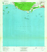
1962 Map of Punta Cucharas
USGS Topo · Published 1964About this map
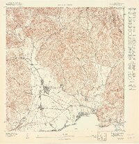
Playa de Ponce stands as a primary focal point along the southern coast of Puerto Rico in this mid-century survey, showing the urban expansion of Canas Urbano and the development of Los Pámpanos. The landscape is defined by the transition from the rugged Peñón de Ponce and the coastal hills of Encarnacion down to the mangrove-fringed shoreline. Industrial and infrastructure markers of the era are evident, including the Antigua Vía del Ferrocarril and radio towers for Wiso and Wpab.
Find a feature on this map
40 named features on this map. Tap any name to fly to it.
Don’t see what you’re looking for? This feature index may not catch every label — zoom into the map to look around manually.
Map Details
Editions of this 1962 Punta Cucharas Map
4 editions found
Other maps of this area

1945 · Playa De Ponce
USGS Topo · 1:30,000

1945 · Ponce
USGS Topo · 1:30,000

1946 · Punta Cuchara
USGS Topo · 1:30,000

1946 · Yauco
USGS Topo · 1:30,000

1946 · Punta Verraco
USGS Topo · 1:30,000

1946 · Penuelas
USGS Topo · 1:30,000

1947 · Punta Gughara NE
USGS Topo · 1:10,000
1947 · Yauco SE
USGS Topo · 1:10,000

1947 · Ponce SO
USGS Topo · 1:10,000
1947 · Punta Verraco NE
USGS Topo · 1:10,000