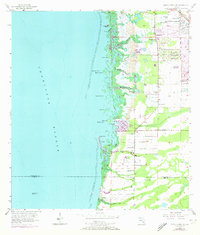
1956 Map of Punta Gorda SE
USGS Topo · Published 1973About this map
Charlotte Harbor dominates the western half of this coastal landscape, where the shifting shoreline meets a complex network of mangrove keys and tidal creeks. The eastern interior shows the early development of South Punta Gorda Heights and Tropical Gulf Acres, neighborhoods defined by a rigid grid of roads that contrast with the organic meander of Yucca Pen Creek and Winegourd Creek. Numerous flowing wells and borrow pits across the flatlands point to the hydrological management required for residential expansion during the mid-20th century. Along the intricate coast, features like Cockroach Mound and Pirate Harbor mark the transition from natural marshes to settled waterfront. The map also captures the maritime navigation of the era, anchored by the Charlotte Harbor Light No 2 and the sheltered waters of John Quiet Lakes.
Find a feature on this map
29 named features on this map. Tap any name to fly to it.
Don’t see what you’re looking for? This feature index may not catch every label — zoom into the map to look around manually.
Map Details
Editions of this 1956 Punta Gorda SE Map
5 editions found
Other maps of this area

1956 · Cleveland
USGS Topo · 1:24,000

1956 · Punta Gorda SE
USGS Topo · 1:24,000

1956 · West Palm Beach
USGS Topo · 1:250,000

1956 · Tampa
USGS Topo · 1:250,000

1956 · Charlotte Harbor
USGS Topo · 1:250,000

1957 · West Palm Beach
USGS Topo · 1:250,000

1957 · El Jobean
USGS Topo · 1:24,000

1957 · Punta Gorda SW
USGS Topo · 1:24,000

1957 · Punta Gorda
USGS Topo · 1:24,000

1957 · Gilchrist
USGS Topo · 1:24,000