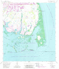
1957 Map of Punta Gorda Sw
USGS Topo · Published 1988About this map
The complex shoreline of the Gasparilla Sound - Charlotte Harbor State Aquatic Preserve reveals a landscape defined by intricate waterways and archaeological heritage. Native history is visible through a cluster of significant landmarks including Mound Key, Indian Mound, Cash Mound, and John Quiet Mound, situated where the mainland meets the shallow estuaries of Turtle Bay. This coastal environment features a mix of tidal creeks and stagnant water bodies such as Whidden Creek, Catfish Creek, and Forty Acre Pond.
Find a feature on this map
33 named features on this map. Tap any name to fly to it.
Don’t see what you’re looking for? This feature index may not catch every label — zoom into the map to look around manually.
Map Details
Editions of this 1957 Punta Gorda Sw Map
4 editions found
Other maps of this area

1956 · Punta Gorda SE
USGS Topo · 1:24,000

1956 · Englewood
USGS Topo · 1:24,000

1956 · Tampa
USGS Topo · 1:250,000

1956 · Charlotte Harbor
USGS Topo · 1:250,000

1957 · El Jobean
USGS Topo · 1:24,000

1957 · Punta Gorda SW
USGS Topo · 1:24,000

1957 · Punta Gorda
USGS Topo · 1:24,000

1957 · Placida
USGS Topo · 1:24,000

1958 · Matlacha
USGS Topo · 1:24,000

1958 · Port Boca Grande
USGS Topo · 1:24,000