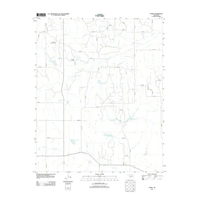
2012 Map of Purdy
USGS Topo · Published 2012About this map
Purdy serves as the central settlement of this Garvin County landscape, where the rural road network intersects with historical local markers like the Purdy Cem. The terrain is significantly defined by a series of water management projects, including the Rush Creek Site 38 Reservoir and numerous numbered reservoirs along Wildhorse Creek. These sites, such as Wildhorse Creek Site 89 Reservoir, illustrate the modern hydraulic engineering of the region's drainage basins. Transport and utility in the area are represented by the Bearden Private Airstrip and the winding course of Rush Cr and Wildcat Cr. The map captures a transition in Oklahoma's rural infrastructure, where old routes like Old Hwy 7 meet a modern grid of county roads.
Find a feature on this map
45 named features on this map. Tap any name to fly to it.
Don’t see what you’re looking for? This feature index may not catch every label — zoom into the map to look around manually.
Map Details
Editions of this 2012 Purdy Map
This is the sole edition of this map. No revisions or reprints were ever made.
Other maps of this area

1898 · Pauls Valley
USGS Topo · 1:125,000

1902 · Pauls Valley
USGS Topo · 1:125,000

1902 · Rush Springs
USGS Topo · 1:125,000

1957 · Ardmore
USGS Topo · 1:250,000

1963 · Ardmore
USGS Topo · 1:250,000

1965 · Maysville
USGS Topo · 1:24,000

1966 · Lindsay
USGS Topo · 1:24,000

1966 · Lindsay SW
USGS Topo · 1:24,000
1969 · Elmore City North
USGS Topo · 1:24,000
1969 · Elmore City South
USGS Topo · 1:24,000