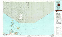
1986 Map of Put-In-Bay
USGS Topo · Published 1994About this map
Lake Erie defines the character of this region, serving as a maritime crossroads where the international boundary between the United States and Canada splits the open water. The map detail highlights the unique archipelago of the Bass Islands, including the village of Put-in-Bay and the towering Perrys Nat Mon. On the Ohio mainland, the landscape transitions from the residential streets of Port Clinton to the industrial activity of Gypsum and the active quarries near Marblehead.
Find a feature on this map
57 named features on this map. Tap any name to fly to it.
Don’t see what you’re looking for? This feature index may not catch every label — zoom into the map to look around manually.
Map Details
Editions of this 1986 Put-In-Bay Map
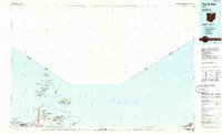
2 editions found
Other maps of this area

1900 · Oak Harbor
USGS Topo · 1:62,500

1901 · Oberlin
USGS Topo · 1:62,500

1901 · Put-In-Bay
USGS Topo · 1:62,500

1901 · Bellevue
USGS Topo · 1:62,500

1901 · Fremont
USGS Topo · 1:62,500

1902 · Berea
USGS Topo · 1:62,500

1903 · Bellevue
USGS Topo · 1:62,500

1903 · Vermilion
USGS Topo · 1:62,500

1903 · Fremont
USGS Topo · 1:62,500

1903 · Put In Bay
USGS Topo · 1:62,500