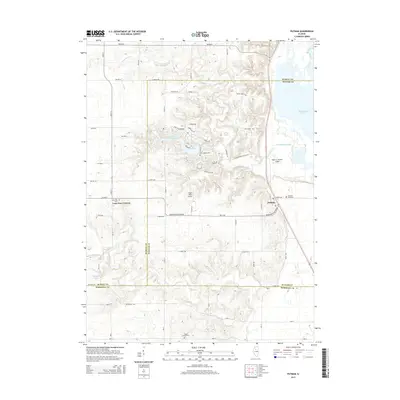
2015 Map of Putnam
USGS Topo · Published 2015About this map
The community of Putnam and the intersection at Lone Tree Corners anchor this 2015 study of the Illinois River valley's western bluffs. The landscape is defined by the sharp transition between flat agricultural uplands and the deeply dissected ravines leading toward the massive Senachwine Lake. A modern suburban-style residential pattern is visible surrounding Lake Thunderbird, with streets like Catalina Dr and Barbados Dr winding through the wooded terrain near Saint Joseph Cem. This development contrasts with the traditional grid of rural routes such as 700 Ave N and Bradford Blacktop Rd. Local transit and aviation history are preserved through sites like the Ralph E. Daniels Airport and Edgar Read Airport, while family history is marked at Lone Tree Cem and Sugar Grove Cem along the quiet drainage of Crow Cr.
Find a feature on this map
51 named features on this map. Tap any name to fly to it.
Don’t see what you’re looking for? This feature index may not catch every label — zoom into the map to look around manually.
Map Details
Editions of this 2015 Putnam Map
This is the sole edition of this map. No revisions or reprints were ever made.
Other maps of this area

1893 · Lacon
USGS Topo · 1:62,500

1893 · Hennepin
USGS Topo · 1:62,500

1909 · Hennepin
USGS Topo · 1:62,500

1911 · Hennepin
USGS Topo · 1:62,500

1921 · Buda
USGS Topo · 1:62,500

1923 · Buda
USGS Topo · 1:62,500

1933 · Lacon
USGS Topo · 1:62,500

1933 · Camp Grove
USGS Topo · 1:48,000

1937 · Lacon
USGS Topo · 1:62,500

1945 · Bradford
USGS Topo · 1:62,500