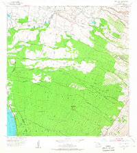
1954 Map of Puu O Kali
USGS Topo · Published 1967About this map
Airport Village and the Maui Airport define the northwest corner of this mid-century landscape on Maui, where industrial and agricultural infrastructure meets the shoreline of the Pacific Ocean. The transition from coastal settlements like Kamaole and Liilioholo to the upland slopes is marked by an extensive system of water management, evidenced by numerous tanks, the Ditch system, and a network of reservoirs. Moving inland, the terrain is deeply incised by a series of gulches, including Waipuilani Gulch and Naalae Gulch, which dictate the placement of roads and homesteads.
Find a feature on this map
53 named features on this map. Tap any name to fly to it.
Don’t see what you’re looking for? This feature index may not catch every label — zoom into the map to look around manually.
Map Details
Editions of this 1954 Puu O Kali Map
2 editions found
Other maps of this area

1954 · Maui
USGS Topo · 1:250,000

1954 · Maalaea
USGS Topo · 1:24,000

1954 · Paia
USGS Topo · 1:24,000

1954 · Puu O Kali
USGS Topo · 1:24,000

1954 · Makena
USGS Topo · 1:24,000

1955 · Wailuku
USGS Topo · 1:24,000

1957 · Kilohana
USGS Topo · 1:24,000

1957 · Haiku
USGS Topo · 1:24,000

1957 · Lualailua Hills
USGS Topo · 1:24,000

1966 · Maui
USGS Topo · 1:250,000