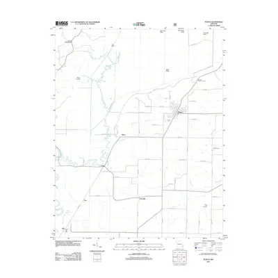
2012 Map of Puxico
USGS Topo · Published 2012About this map
Puxico stands as the central hub of this Missouri landscape, where the flatlands meet a network of ridges and drainage systems. The town is surrounded by smaller settlements like Asherville, Cobb, and Mingo, reflecting a distribution of rural communities connected by a dense grid of county roads. The topography is defined by distinctive features such as Devils Washboard and Fry Bluff, while the lowlands are carved by the Saint Francis River, Stanley Creek, and Mingo Creek. Genealogists and local historians can find points of interest including Clubb Cemetery, Rock Hill Cemetery, and the Reece Post Office in the southwestern corner near Dale. The area's northern reaches are marked by a series of high points like Bee Press Ridge and Sand Blow Ridge, while the eastern side features the Red Mill Hunters Entrance, suggesting the local importance of managed conservation areas and traditional land use.
Find a feature on this map
66 named features on this map. Tap any name to fly to it.
Don’t see what you’re looking for? This feature index may not catch every label — zoom into the map to look around manually.
Map Details
Editions of this 2012 Puxico Map
This is the sole edition of this map. No revisions or reprints were ever made.
Other maps of this area

1934 · Greenville
USGS Topo · 1:62,500

1934 · Puxico
USGS Topo · 1:62,500

1935 · Poplar Bluff
USGS Topo · 1:62,500

1935 · Zalma
USGS Topo · 1:62,500

1939 · Greenville
USGS Topo · 1:62,500

1939 · Puxico
USGS Topo · 1:62,500

1939 · Zalma
USGS Topo · 1:62,500

1939 · Poplar Bluff
USGS Topo · 1:62,500

1949 · Rolla
USGS Topo · 1:250,000

1949 · Poplar Bluff
USGS Topo · 1:62,500