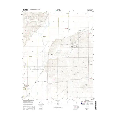
2015 Map of Puxico
USGS Topo · Published 2015About this map
Puxico serves as the primary hub of this landscape, situated at a junction where the drainage of the Mingo Basin meets higher ground. The map reveals an intricate network of waterways and man-made drainage systems, such as Coal Oil Johnny Ditch and Mingo Ditch, which underscore the region's history of land reclamation and water management. To the west, the Mark Twain National Forest provides a backdrop of protected terrain near Dale, while the east is characterized by smaller communities like Asherville and Cobb. Genealogical interest is found in local landmarks like Gravel Hill Cemetery and Rock Hill Cemetery. Distinctive topographic features like Devils Washboard and Fry Bluff rise above the wetlands, defining the transition from the river bottoms near the Saint Francis River to the ridges like Shaw Ridge and Bee Press Ridge.
Find a feature on this map
91 named features on this map. Tap any name to fly to it.
Don’t see what you’re looking for? This feature index may not catch every label — zoom into the map to look around manually.
Map Details
Editions of this 2015 Puxico Map
This is the sole edition of this map. No revisions or reprints were ever made.
Other maps of this area

1934 · Greenville
USGS Topo · 1:62,500

1934 · Puxico
USGS Topo · 1:62,500

1935 · Poplar Bluff
USGS Topo · 1:62,500

1935 · Zalma
USGS Topo · 1:62,500

1939 · Greenville
USGS Topo · 1:62,500

1939 · Puxico
USGS Topo · 1:62,500

1939 · Zalma
USGS Topo · 1:62,500

1939 · Poplar Bluff
USGS Topo · 1:62,500

1949 · Rolla
USGS Topo · 1:250,000

1949 · Poplar Bluff
USGS Topo · 1:62,500