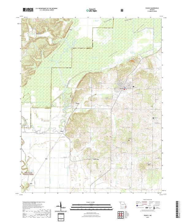
2021 Map of Puxico
USGS Topo · Published 2021About this map
Mingo National Wildlife Refuge dominates the northern half of this landscape, where the transition from the Ozark Escarpment meets the flatlands of the Missouri Bootheel. The topography is defined by significant ridges such as Bee Press Ridge and Shaw Ridge, which rise above the hydrologically complex Mingo Swamp and Monopoly Marsh. This area shows a legacy of water management and conservation, with numerous named drainage features like Coal Oil Johnny Ditch and Mingo Ditch redirecting the natural flow of Turkey Cr and Mingo Creek.
Find a feature on this map
86 named features on this map. Tap any name to fly to it.
Don’t see what you’re looking for? This feature index may not catch every label — zoom into the map to look around manually.
Map Details
Editions of this 2021 Puxico Map
This is the sole edition of this map. No revisions or reprints were ever made.
Other maps of this area

1934 · Greenville
USGS Topo · 1:62,500

1934 · Puxico
USGS Topo · 1:62,500

1935 · Poplar Bluff
USGS Topo · 1:62,500

1935 · Zalma
USGS Topo · 1:62,500

1939 · Greenville
USGS Topo · 1:62,500

1939 · Puxico
USGS Topo · 1:62,500

1939 · Zalma
USGS Topo · 1:62,500

1939 · Poplar Bluff
USGS Topo · 1:62,500

1949 · Rolla
USGS Topo · 1:250,000

1949 · Poplar Bluff
USGS Topo · 1:62,500