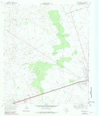
1969 Map of Pyote West
USGS Topo · Published 1981About this map
Pyote Flats and the industrial infrastructure of the Permian Basin define this 1960s landscape in Ward County. The map documents the intersection of rail transport and energy extraction, centered on the Missouri Pacific railroad line and the town of Pyote. Beyond the residential center, the survey reveals a vast network of pipelines and specialized resource extraction sites, including a Borax Well and Gyp Well, which point to the region's diverse mineral wealth.
Find a feature on this map
13 named features on this map. Tap any name to fly to it.
Don’t see what you’re looking for? This feature index may not catch every label — zoom into the map to look around manually.
Map Details
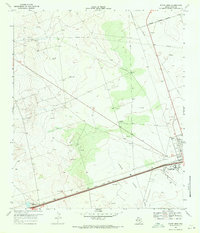
Editions of this 1969 Pyote West Map
2 editions found
Other maps of this area

1931 · Barstow
USGS Topo · 1:125,000

1954 · Pecos
USGS Topo · 1:250,000

1957 · Pecos
USGS Topo · 1:250,000

1963 · Quito Draw
USGS Topo · 1:24,000

1963 · China Lake NE
USGS Topo · 1:24,000

1963 · China Lake
USGS Topo · 1:24,000

1968 · Soda Lake SE
USGS Topo · 1:24,000

1968 · Wink South
USGS Topo · 1:24,000

1968 · Soda Lake NE
USGS Topo · 1:24,000

1969 · Pyote NE
USGS Topo · 1:24,000