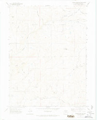
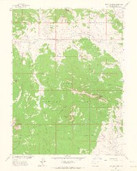
1971 Map of Quaker Mountain
USGS Topo · Published 1974About this map
The Routt National Forest landscape is defined by high-elevation terrain and a network of drainage basins in the early 1970s. The small settlement of Elkhead serves as a central reference point among the varied peaks and ridges of the region. Prominent geological features include the 9,370-foot summit of Quaker Mountain and the distinctive Finger Rock, which rises above Jones Creek. The map shows a landscape transitioning between natural wilderness and early resource utilization, evidenced by the presence of a Mine in the southeastern corner and isolated structures like the Mc Kinlay No 2 and various Silo and Corral locations. A complex hydrological system of seasonal and perennial streams, such as Hole-in-the-Wall Creek, Stukey Creek, and Mill Creek, flows through the canyons and gulches, illustrating the natural water management of the upper Colorado high country.
Find a feature on this map
26 named features on this map. Tap any name to fly to it.
Don’t see what you’re looking for? This feature index may not catch every label — zoom into the map to look around manually.
Map Details
Editions of this 1971 Quaker Mountain Map
4 editions found
Other maps of this area

1923 · Elkhead Creek
USGS Topo · 1:62,500

1923 · Pilot Knob
USGS Topo · 1:62,500

1924 · Elkhead Creek
USGS Topo · 1:62,500

1925 · Pilot Knob
USGS Topo · 1:62,500

1954 · Craig
USGS Topo · 1:250,000

1957 · Craig
USGS Topo · 1:250,000

1958 · Craig
USGS Topo · 1:250,000

1960 · Craig
USGS Topo · 1:250,000

1962 · Craig
USGS Topo · 1:250,000
1962 · Bears Ears Peaks
USGS Topo · 1:24,000