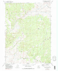
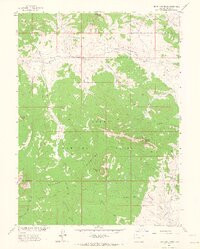
1971 Map of Quaker Mountain
USGS Topo · Published 1979About this map
Routt National Forest dominates this northern Colorado landscape, where steep drainages and mountain peaks defined the limits of local industry in the early 1970s. The settlement of Elkhead sits near the confluence of several high-country waterways, including Elkhead Creek and the curiously named Hole-in-the-Wall Creek. The terrain is marked by significant elevations like Quaker Mountain and Baldy Peak, with lower slopes dissected by narrow gulches such as Bull Gulch and Jones Draw. A single Mine located in the southeastern corner suggests the persistent search for mineral wealth that characterized the region's history. While the area is largely defined by its natural features, including the distinct Finger Rock and Agner Mountain, a network of Jeep Trails provides the primary evidence of human access into these high-altitude timber and grazing lands.
Find a feature on this map
23 named features on this map. Tap any name to fly to it.
Don’t see what you’re looking for? This feature index may not catch every label — zoom into the map to look around manually.
Map Details
Editions of this 1971 Quaker Mountain Map
4 editions found
Other maps of this area

1923 · Elkhead Creek
USGS Topo · 1:62,500

1923 · Pilot Knob
USGS Topo · 1:62,500

1924 · Elkhead Creek
USGS Topo · 1:62,500

1925 · Pilot Knob
USGS Topo · 1:62,500

1954 · Craig
USGS Topo · 1:250,000

1957 · Craig
USGS Topo · 1:250,000

1958 · Craig
USGS Topo · 1:250,000

1960 · Craig
USGS Topo · 1:250,000

1962 · Craig
USGS Topo · 1:250,000
1962 · Bears Ears Peaks
USGS Topo · 1:24,000