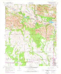
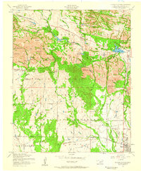
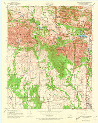
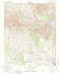
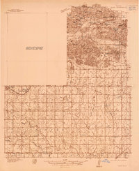
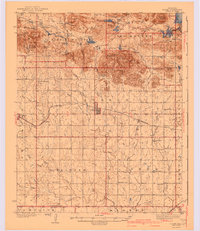
1956 Map of Quanah Mountain
USGS Topo · Published 1976About this map
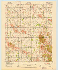
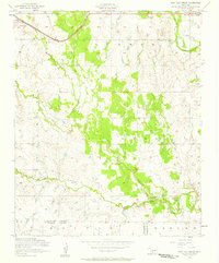
Wichita Mountains Wildlife Refuge occupies the northern half of this terrain, where the landscape is defined by a dense concentration of named peaks including Mount Lincoln, Quanah Mountain, and Elk Mountain. The boundary between the refuge and the Fort Sill Military Reservation to the south creates a sharp contrast in land use, with the northern section dedicated to conservation and the southern section to military operations. Key infrastructure like the St Louis - San Francisco railroad and the Scenic Highway facilitate movement through this complex geography. Water management is evident through numerous reservoirs such as Quanah Parker Lake, French Lake, and Caddo Lake. The presence of Official Dog Town and the Quanah Parker Camp suggests a blend of ecological study and public recreation in the mid-20th century. To the south, the communities of Cache and Indiahoma anchor the map at the edge of the military reservation.
Find a feature on this map
66 named features on this map. Tap any name to fly to it.
Don’t see what you’re looking for? This feature index may not catch every label — zoom into the map to look around manually.
Map Details
Editions of this 1956 Quanah Mountain Map
4 editions found
Other maps of this area
1937 · Cache
USGS Topo · 1:48,000

1937 · Quanah Mountain
USGS Topo · 1:24,000
1942 · Cache
USGS Topo · 1:62,500

1949 · Mount Scott
USGS Topo · 1:24,000
1949 · Cooperton
USGS Topo · 1:62,500

1949 · Quanah Mountain
USGS Topo · 1:24,000

1950 · Snyder
USGS Topo · 1:62,500

1950 · Saddle Mountain
USGS Topo · 1:62,500

1955 · Lawton
USGS Topo · 1:250,000
1956 · Post Oak Creek
USGS Topo · 1:24,000