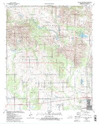
1991 Map of Quanah Mountain
USGS Topo · Published 1992About this map
Wichita Mountains National Wildlife Refuge dominates this landscape, showing a complex of protected wilderness and military activity in the early 1990s. The northern half of the map is defined by the granite peaks and canyons of the Wichita Mountains, including Elk Mountain, Mount Lincoln, and Quanah Mountain. These peaks are interspersed with recreational and managed sites like Quanah Parker Lake and the Charons Garden Wilderness. Evidence of the area's mineral history appears at the Bonanza Mine and Pennington Mine.
Find a feature on this map
69 named features on this map. Tap any name to fly to it.
Don’t see what you’re looking for? This feature index may not catch every label — zoom into the map to look around manually.
Map Details
Editions of this 1991 Quanah Mountain Map
2 editions found
Other maps of this area

1937 · Cache
USGS Topo · 1:48,000

1937 · Quanah Mountain
USGS Topo · 1:24,000

1942 · Cache
USGS Topo · 1:62,500

1949 · Mount Scott
USGS Topo · 1:24,000

1949 · Cooperton
USGS Topo · 1:62,500

1949 · Quanah Mountain
USGS Topo · 1:24,000

1950 · Snyder
USGS Topo · 1:62,500

1950 · Saddle Mountain
USGS Topo · 1:62,500

1955 · Lawton
USGS Topo · 1:250,000

1956 · Post Oak Creek
USGS Topo · 1:24,000