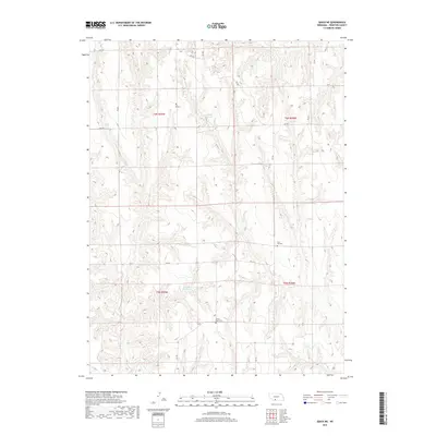
2017 Map of Quick NE
USGS Topo · Published 2017About this map
Frontier County's rolling upland landscape is defined by its deep drainage patterns and agricultural grid in this 2017 survey. The territory is punctuated by several water features, notably the Lashley Reservoir in the north and the Schow Reservoir further south, which provide essential water management for the surrounding plains. The local geography is etched by the winding path of Coon Cr as it carves through the terrain in the southeastern section. For those researching local history or genealogy, the map identifies two significant landmarks: Zion Hill Cem and Center Point Cem, both of which serve as focal points for the rural community. A network of section roads, such as RD 390 and RD 731, provides the primary infrastructure for this sparsely settled part of Nebraska.
Find a feature on this map
21 named features on this map. Tap any name to fly to it.
Don’t see what you’re looking for? This feature index may not catch every label — zoom into the map to look around manually.
Map Details
Editions of this 2017 Quick NE Map
This is the sole edition of this map. No revisions or reprints were ever made.
Other maps of this area

1902 · Gothenburg
USGS Topo · 1:125,000

1954 · McCook
USGS Topo · 1:250,000

1956 · Curtis SW
USGS Topo · 1:24,000

1956 · Quick NE
USGS Topo · 1:24,000

1956 · Curtis SE
USGS Topo · 1:24,000

1956 · Stockville
USGS Topo · 1:24,000

1956 · Bartley NW
USGS Topo · 1:24,000

1957 · McCook
USGS Topo · 1:250,000

1958 · McCook
USGS Topo · 1:250,000

1970 · Red Willow Dam
USGS Topo · 1:24,000