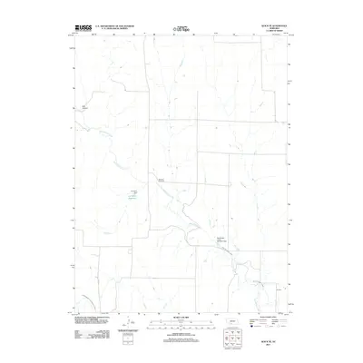
2011 Map of Quick SE
USGS Topo · Published 2011About this map
Red Willow Creek winds through this agricultural landscape of southwestern Nebraska, illustrating the vital role of water management in the region's development. The map details an extensive irrigation network, including the Red Willow Canal and the Culbertson Extension Canal, which draw from the creek's flow. Infrastructure projects like the Larington Dam, which creates the Larington Reservoir, and the Red Willow Creek Diversion Dam further downstream, highlight the engineered nature of the modern plains. For those tracing local history or family roots, the Box Elder Cemetery remains a fixed point on the landscape, while Bee Canyon provides a named landmark for the area's natural topography. The straight lines of E 11th St and other section roads define the local transit patterns, connecting isolated farms to the broader county network.
Find a feature on this map
9 named features on this map. Tap any name to fly to it.
Don’t see what you’re looking for? This feature index may not catch every label — zoom into the map to look around manually.
Map Details
Editions of this 2011 Quick SE Map
This is the sole edition of this map. No revisions or reprints were ever made.
Other maps of this area

1954 · McCook
USGS Topo · 1:250,000

1956 · Quick NE
USGS Topo · 1:24,000

1956 · Bartley NW
USGS Topo · 1:24,000

1957 · McCook
USGS Topo · 1:250,000

1958 · McCook
USGS Topo · 1:250,000
1958 · Indianola
USGS Topo · 1:24,000

1970 · Red Willow Dam
USGS Topo · 1:24,000

1970 · Quick
USGS Topo · 1:24,000

1970 · McCook West
USGS Topo · 1:24,000

1970 · Quick SE
USGS Topo · 1:24,000