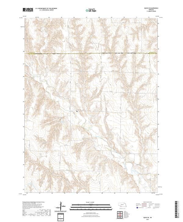
2021 Map of Quick SE
USGS Topo · Published 2021About this map
Red Willow Cr snakes through the canyon-carved terrain of Southwest Nebraska, defining the irrigation-focused landscape of this region. The map reveals a complex water management system essential for high-plains agriculture, including the Larington Reservoir and a network of arterial waterways like the Culbertson Extension Canal and Red Willow Canal. These features illustrate the transformation of the semi-arid prairie into productive farmland during the 20th and early 21st centuries. Local history and genealogy researchers will find the Box Elder Cem situated near the center of the sheet, providing a precise anchor for family ties in Frontier and Red Willow counties. The land's natural character is punctuated by deep drainage features like Bee Canyon and River Canyon, which interrupt the grid of section roads that organize the Nebraska plains.
Find a feature on this map
30 named features on this map. Tap any name to fly to it.
Don’t see what you’re looking for? This feature index may not catch every label — zoom into the map to look around manually.
Map Details
Editions of this 2021 Quick SE Map
This is the sole edition of this map. No revisions or reprints were ever made.
Other maps of this area

1954 · McCook
USGS Topo · 1:250,000

1956 · Quick NE
USGS Topo · 1:24,000

1956 · Bartley NW
USGS Topo · 1:24,000

1957 · McCook
USGS Topo · 1:250,000

1958 · McCook
USGS Topo · 1:250,000
1958 · Indianola
USGS Topo · 1:24,000

1970 · Red Willow Dam
USGS Topo · 1:24,000

1970 · Quick
USGS Topo · 1:24,000

1970 · McCook West
USGS Topo · 1:24,000

1970 · Quick SE
USGS Topo · 1:24,000