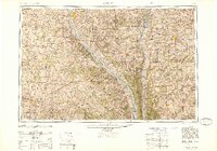
1948 Map of Quincy
USGS Topo · Published 1948About this map
The Mississippi River and the Illinois River dominate this landscape, defining the rich alluvial bottoms and rugged bluffs of the tri-state border region. On the Illinois side, Quincy and Jacksonville serve as major regional hubs, while Hannibal and Louisiana anchor the Missouri bank. A complex network of waterways, including the Salt River, Fabius River, and the intricate drainage of The Sny, illustrates the hydrological challenges and fertile potential of the river valleys.
Find a feature on this map
172 named features on this map. Tap any name to fly to it.
Don’t see what you’re looking for? This feature index may not catch every label — zoom into the map to look around manually.
Map Details
Editions of this 1948 Quincy Map
2 editions found

Other maps of this area

1886 · Jefferson City
USGS Topo · 1:125,000

1890 · Louisiana
USGS Topo · 1:125,000

1890 · Mexico
USGS Topo · 1:125,000

1890 · Moberly
USGS Topo · 1:125,000

1890 · Hermann
USGS Topo · 1:125,000

1890 · Fulton
USGS Topo · 1:125,000

1894 · Jefferson City
USGS Topo · 1:125,000

1903 · O'Fallon
USGS Topo · 1:125,000

1903 · Kahoka
USGS Topo · 1:125,000

1903 · Palmyra
USGS Topo · 1:125,000