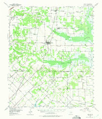
1956 Map of Quinlan
USGS Topo · Published 1975About this map
The Texas and New Orleans railroad line cuts through this 1956 survey of the Blackland Prairie region, anchoring the town of Quinlan. The landscape is defined by the convergence of the South Fork Sabine River and its numerous tributaries, including Duck Creek and Greasy Creek. A significant social landmark of the era is the Boles Home, located just north of town.
Find a feature on this map
69 named features on this map. Tap any name to fly to it.
Don’t see what you’re looking for? This feature index may not catch every label — zoom into the map to look around manually.
Map Details
Editions of this 1956 Quinlan Map
3 editions found
Other maps of this area

1919 · Royse City
USGS Topo · 1:62,500

1930 · Farmersville
USGS Topo · 1:62,500

1953 · Texarkana
USGS Topo · 1:250,000

1954 · Dallas
USGS Topo · 1:250,000

1954 · Sherman
USGS Topo · 1:250,000

1956 · Texarkana
USGS Topo · 1:250,000

1956 · Kaufman
USGS Topo · 1:62,500

1956 · Tyler
USGS Topo · 1:250,000

1956 · Quinlan
USGS Topo · 1:62,500

1956 · Emory
USGS Topo · 1:62,500