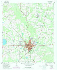
1974 Map of Quitman
USGS Topo · Published 1987About this map
Quitman serves as the focal point of this Brooks County survey, where the convergence of the CSX and the Live Oak Perry and South Georgia RR defines the town's industrial and transportation layout. The map documents a classic South Georgia landscape, characterized by the winding path of Okapilco Creek and its many tributaries, including Possum Branch and Coon Creek. Evidence of civic and social life is concentrated in the town center, featuring the Court House, Post Office, and Armory.
Find a feature on this map
42 named features on this map. Tap any name to fly to it.
Don’t see what you’re looking for? This feature index may not catch every label — zoom into the map to look around manually.
Map Details
Editions of this 1974 Quitman Map
This is the sole edition of this map. No revisions or reprints were ever made.
Other maps of this area

1954 · Valdosta
USGS Topo · 1:250,000

1956 · Grooverville
USGS Topo · 1:24,000

1956 · Nankin
USGS Topo · 1:24,000

1956 · Baden
USGS Topo · 1:24,000

1958 · Valdosta
USGS Topo · 1:250,000

1959 · Valdosta
USGS Topo · 1:250,000

1961 · Quitman
USGS Topo · 1:62,500

1961 · Hahira West
USGS Topo · 1:24,000

1961 · Ousley
USGS Topo · 1:24,000
1975 · Pebble Hill
USGS Topo · 1:24,000