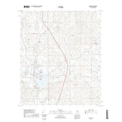
2018 Map of Quitman
USGS Topo · Published 2018About this map
Quitman serves as the focal point of this Clarke County landscape, situated where the Chickasawhay River and its tributaries define the local geography. The town's layout is centered near the junction of several drainage systems, including Archusa Cr and Tallabogue Cr. For those tracing local families, the map is dense with burial sites such as the Confederate Cem, Quitman Cem, and Sutlers Cem, which reflect the area's deep-rooted history.
Find a feature on this map
106 named features on this map. Tap any name to fly to it.
Don’t see what you’re looking for? This feature index may not catch every label — zoom into the map to look around manually.
Map Details
Editions of this 2018 Quitman Map
This is the sole edition of this map. No revisions or reprints were ever made.
Other maps of this area

1953 · Hattiesburg
USGS Topo · 1:250,000

1953 · Meridian
USGS Topo · 1:250,000

1957 · Meridian
USGS Topo · 1:250,000

1957 · Quitman
USGS Topo · 1:62,500

1957 · Enterprise
USGS Topo · 1:62,500

1958 · Hattiesburg
USGS Topo · 1:250,000

1964 · Carmichael
USGS Topo · 1:24,000

1964 · Hale
USGS Topo · 1:24,000

1964 · De Soto
USGS Topo · 1:24,000

1965 · Meridian
USGS Topo · 1:250,000