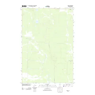
2013 Map of Rabey
USGS Topo · Published 2013About this map
The small settlement of Rabey sits at the northern edge of this landscape, where the northern Minnesota forest gives way to an extensive system of waterways and drainage infrastructure. This 2013 survey illustrates the complex hydrography of Aitkin County, defined by the winding course of the Willow River and the artificial straight lines of the Hill River Ditch. These ditches, typical of the region's efforts to manage peatlands and wetlands, slice through the terrain to connect natural bodies of water like Washburn Lake and Langs Lake. Road access is limited to a few key arteries such as Washburn Lake Rd and Pokegama Creek Forest Rd, which navigate the marshy ground near Pokegama Cr. The map provides a clear look at how human engineering has sought to stabilize and traverse this water-dominant environment while preserving its characteristic lake and river systems.
Find a feature on this map
9 named features on this map. Tap any name to fly to it.
Don’t see what you’re looking for? This feature index may not catch every label — zoom into the map to look around manually.
Map Details
Editions of this 2013 Rabey Map
This is the sole edition of this map. No revisions or reprints were ever made.
Other maps of this area

1953 · Duluth
USGS Topo · 1:250,000

1954 · Hibbing
USGS Topo · 1:250,000

1957 · Hibbing
USGS Topo · 1:250,000

1958 · Hibbing
USGS Topo · 1:250,000

1958 · Duluth
USGS Topo · 1:250,000

1964 · Hibbing
USGS Topo · 1:250,000

1970 · Split Hand Lake
USGS Topo · 1:24,000

1970 · Rabey
USGS Topo · 1:24,000
1970 · Mountain Ash Lake
USGS Topo · 1:24,000

1970 · Sanders Lake
USGS Topo · 1:24,000