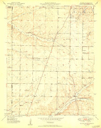
1950 Map of Racine
USGS Topo · Published 1950About this map
Shoal Creek cuts through the northeast corner of this 1950 survey, providing a focal point for the early industry and settlement patterns along the Missouri-Oklahoma border. The landscape is defined by its distinct natural openings, including Five Mile Prairie and Burkhart Prairie, which historically influenced the placement of rural institutions like Five Mile Sch and Burkhart Ch. The extractive economy of the era is evidenced by several Tripoli Mines scattered near the state line, while the St Louis San Francisco railroad connects the village of Racine to the broader regional market. Local history is deeply embedded in family-named landmarks and cemeteries, such as Gibson Cem and Moser Cem, which serve as permanent markers of the families who settled this tri-state area. The presence of numerous small schools like East View Sch and Frog Pond Sch reflects the dense rural population before the mid-century trend toward school consolidation.
Find a feature on this map
42 named features on this map. Tap any name to fly to it.
Don’t see what you’re looking for? This feature index may not catch every label — zoom into the map to look around manually.
Map Details
Editions of this 1950 Racine Map
2 editions found

Other maps of this area

1886 · Joplin
USGS Topo · 1:125,000

1886 · Carthage
USGS Topo · 1:125,000

1894 · Joplin
USGS Topo · 1:125,000

1894 · Carthage
USGS Topo · 1:125,000

1907 · Wyandotte
USGS Topo · 1:125,000

1909 · Wyandotte
USGS Topo · 1:125,000

1916 · Neosho
USGS Topo · 1:62,500

1947 · Joplin
USGS Topo · 1:250,000

1949 · Joplin
USGS Topo · 1:250,000

1949 · Seneca
USGS Topo · 1:24,000